Hunting Maps
 It was my last day of duck hunting for the year and, as usual, it came with mixed emotions. Time spent bird hunting with Pisgah is priceless. Bird hunting creates a bond with a dog transcending the level of just a pet. I hike and backpack with her during the hunting offseason, but it’s never the same as sitting in a blind, or working a field. The last day of bird season is bittersweet. I’m filled with memories of bird hunting with my dog while I countdown the days until next season.
A new sport, however, is gaining momentum every year adding a few more months of quality hunting time. When the snow begins to melt amid warming March days, shed antlers wait like treasures for your bird dog.
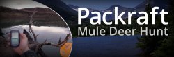
"What's that?" The other hunter motioned toward the large bag that was strapped to my hunting pack.
"A packraft. I'm going to float my deer out." He gave me an amused look and then started off down-river from the parking lot. We had both drawn a WMA (Wildlife Management Area) access permit that was valid only for the first week in November. It was the first day of that week and I felt like a complete rookie. I had never hunted the area and had only been able to scout it using my onXmaps HUNT App and Google Earth. The area was walk-in only with only one public access point. On the recommendation of a friend who knew the area, I decided to use the river that ran through the WMA to float out whatever I shot.
Click Read More to hear more from Matt Harrington on using his packraft to haul his deer out!
 As leaves fall and aspens change from green to gold, big game hunters are sighting in rifles and washing their finest blaze orange, all in hopes to catch a glimpse of antlers. Opening day is to avid sportsmen what Christmas morning is to kids. However, strict regulations, lack of public land and low game numbers make it hard to stock the freezer in some states. For those who can afford it, hunting out of state can offer a lifetime of memories and a chance to chase big game that may otherwise exist only in magazine articles. Picking the right state and planning the hunt is no easy task, however. Big game hunting tags must be bought, drawings entered, and regulations studied before starting an expedition. Where to start? Click Read More for a list of the five states that offer the best chances to bag a coveted bull, buck, or bear.
What’s the first thing that comes to mind when you mention Hawaii? Visions of white sand beaches, hula dancers and feasting at luaus? Many travel to the islands seeking the beautiful weather, sightseeing opportunities and five star amenities. However, Hawaii has much more to offer including many outdoor activities; surfing, spear fishing, deep sea/shore fishing, scuba diving, hiking, and hunting just to name a few.
 Click Read More to hear Team HUNT Pro Team Member Ryan Sanpei's stories from the islands!
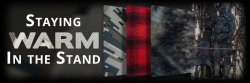
One of the keys to a successful whitetail hunt is actually being in the stand when the buck you are chasing screws up and shows itself in the daylight. However, there are many variables that would cause you as a hunter to get out of the stand and head back to camp. Probably the number one reason was that you got cold or wet while hanging in the tree. Planning ahead and having the right gear with you can eliminate weather conditions from the equation.
Click Read More to learn Ed Gramza's tried and true methods to stay warm in the stand!
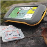
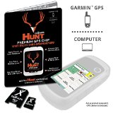
You asked, and we listened. By radically changing our HUNT App, onXmaps is breaking barriers to make your hunt even better! Hunting in today’s modern age is evolving, just like your digital camera has been replaced by your smartphone, so has your handheld GPS. Today, we usher in a new era of GPS. HUNT 3.0 brings the functions of a handheld GPS and couples it with mobile capabilities (smartphone or tablet). With new and improved features, HUNT 3.0 will redefine the way you visualize success in the field.
 Click Read More to learn about the ways onXmaps is breaking barriers with HUNT 3.0!
Wild game offers a pride in a cooked meal that cannot be found in store-bought foods. Thanksgiving's roots are based on the hunt and it’s no coincidence that hunting season overlaps with the day of the feast. This year, leave the canned and plastic-wrapped foods at the grocery store and take a deserved pride in the dishes you serve. Click Read More to read a few ideas for recipes curated by Cavan Williams and Team HUNT!
Growing up in the rural Midwest, pheasant hunting was as easy as walking out my back door to the nearest fence line or crop field, and flushing birds. As I have grown older, that is no longer the case. Now it requires traveling many miles or even out of state to pursue upland birds. Though long-term trends are down we are seeing pheasant numbers increasing in many areas, and now is the time to chase these wily roosters.
Click Read More to learn from some tipes from Team HUNT Field Team Member Gabe Hershberger on pheasant hunting and using your HUNT Maps to scout from home prior to hitting the field!
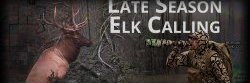
The leaves begin to fall as the rut is winding down across the west. The elk are starting to be less and less vocal. Herd bulls are starting to break off from the herds and feed now seems to be the main thing on an elk’s mind.
BUT...it doesn’t have to mean that elk calls can't be used to improve the success of the hunt. Click Read More to learn Jason Phelps' Top 5 tips for late season elk calling!


You might also like


|
HUNT Regional - Rockies North by onXmaps - Color-coded Lands 24k Topo Maps for Garmin GPS! Covers Idaho, Montana, Wyoming (micro SD/SD Card) Sports (onXmaps)
|
|
HUNT California by onXmaps - Public/Private Land Ownership 24k Topo Maps for Garmin GPS Unit (microSD/SD Card) Sports (onXmaps)
|

|
SWORD KILL Fight a 1 Man War Mobile Application (Cobalt Play Bangladesh)
|
|
Garmin GPSMAP 64st, TOPO U.S. 100K with High-Sensitivity GPS and GLONASS Receiver GPS or Navigation System (Garmin)
|
|
HUNT Regional - Plains by onXmaps - Color-coded Lands 24k Topo Maps for Garmin GPS! Covers Kansas, Nebraska, Missouri, Iowa, Oklahoma (microSD/SD Card) Sports (onXmaps)
|


Popular Q&A

Where is The hunt for the seventh story map.
it is in the book and i cant find it online.


